The deep sea is rich in mineral, oil and gas, biological and other resources, and has become a crucial strategic area for global resource development. However, the deep-sea environment features extreme conditions such as high water pressure (up to over 110MPa, equivalent to the pressure at a depth of 11,000 meters), low temperature (water temperature in most areas ranges from 0 to 4℃), darkness (basically no natural light below 200 meters depth), and complex geological activities (e.g., hydrothermal vents, undersea volcanoes). Traditional exploration methods (such as samplers and sonar detection) struggle to intuitively present the distribution of resources and their correlation with the surrounding environment. Equipped with core advantages like high-pressure resistance design (using materials such as titanium alloy and high-strength ceramics for the body), low-light adaptability (equipped with high-power LED light sources or infrared imaging modules), and high-definition stable imaging (anti-current interference pan-tilt), deep-sea cameras serve as the "visual eyes" for deep-sea resource exploration. Their specific applications can be expanded around three major resource types:
Deep-sea mineral resources (such as polymetallic nodules, cobalt-rich crusts, and hydrothermal sulfides) are key raw materials for the new energy industry (e.g., cobalt and nickel for power batteries). In the exploration of such resources, deep-sea cameras play a triple role of "positioning - assessment - monitoring":
-
Precise Positioning of Resource Distribution: Polymetallic nodules are widely distributed on the abyssal plain at depths of 4,000-6,000 meters. Traditional sonar can only detect general areas, while deep-sea cameras, mounted on autonomous underwater vehicles (AUVs) or manned submersibles (e.g., the "Striver" submersible), can capture images of the seabed topography along preset routes. Through high-definition images, they identify the shape (circular or oval, diameter size), density (number per unit area) of nodules, and mark areas with high-grade nodule enrichment (e.g., areas with nodule coverage exceeding 50%), providing accurate coordinates for subsequent sampling and the deployment of mining equipment. For cobalt-rich crusts distributed on the slopes of seamounts, cameras can capture the attachment thickness of the crusts (judged by comparison with surrounding rocks) and coverage continuity, avoiding resource misjudgment caused by blind sampling.
-
Assessment of Mining Environmental Risks: Deep-sea mineral mining needs to avoid complex geological risks. Cameras can detect obstacles (such as undersea rock protrusions, shipwrecks) and geological stability (e.g., whether there are loose sediment layers, landslide risks) in the mining area in advance. For example, in the exploration of hydrothermal sulfides, cameras can observe the eruption status of hydrothermal vents (e.g., vent shape, hydrothermal color; white hydrothermal fluid usually has a temperature above 300℃), judge whether there are high-temperature risks in the surrounding area, and design obstacle avoidance routes for mining equipment (e.g., remote-controlled mining vehicles). At the same time, they record the distribution of benthic organisms (e.g., hydrothermal shrimp, tube worms) around the minerals, assess the potential impact of mining on the ecological environment, and meet the requirements of environmentally friendly exploration.
-
Visual Recording of the Exploration Process: Cameras can record the entire mineral sampling process (e.g., the moment when the sampler grabs nodules or crusts). Through video playback, the representativeness of the sampled samples is confirmed, avoiding deviations in analysis data caused by improper sampling operations (e.g., sample falling off, mixing with impurities). Meanwhile, the stored high-definition images can be used for subsequent resource reserve estimation. Combined with sample data, the differences in mineral grades in different areas are analyzed, improving the accuracy of exploration reports.
Deep-sea oil and gas resources (oil and gas fields at depths exceeding 500 meters) are an important growth driver for global oil and gas development. Deep-sea cameras are mainly used for wellhead monitoring and surrounding environmental surveys in the later stage of oil and gas exploration, making up for the visual gap of traditional logging technology:
-
Monitoring of Oil and Gas Wellhead and Pipeline Status: In deep-sea oil and gas exploration, it is necessary to deploy test wellheads or temporary oil pipelines in advance. Cameras can be installed around wellheads or along pipelines to capture real-time images of the wellhead sealing status (e.g., whether there are bubble clusters formed by oil and gas leakage, whether seals are damaged) and pipeline integrity (e.g., whether the outer wall of the pipeline is corroded or deformed, whether joints are loose). If continuous bubbles are found at the wellhead (distinguished from natural undersea bubbles), timely early warning of leakage risks can be issued, avoiding resource waste and marine pollution caused by leakage. For the vicinity of deep-water drilling platforms, cameras can monitor the diffusion of drilling fluid after discharge and judge whether it affects the surrounding water quality.
-
Geological Survey Around Oil and Gas Reservoirs: The stability of oil and gas reservoirs is closely related to the surrounding geological structure. Cameras, mounted on underwater robots, can survey the sediment thickness (by capturing the interface between exposed undersea rocks and sediment layers) and fault distribution (e.g., whether there are obvious stratal fracture zones) in the area where the oil and gas field is located, assisting in judging whether there are seepage channels in the oil and gas reservoir. At the same time, they observe whether there are "oil seeps" (oil films or asphalt blocks formed by natural oil and gas seepage) on the seabed. Through the distribution range of oil seeps, the scale and burial depth of the oil and gas reservoir are inferred, providing a reference for the selection of drilling locations.
-
Assistance in Underwater Equipment Operation: During the installation of deep-sea oil and gas exploration equipment (e.g., underwater production systems, logging instruments), cameras can provide real-time images to assist operators in accurately docking the equipment. For example, during the installation of underwater wellhead connectors, cameras are used to observe the alignment between the connector and the wellhead, avoiding installation deviations caused by blocked underwater visibility and improving operation efficiency and safety.
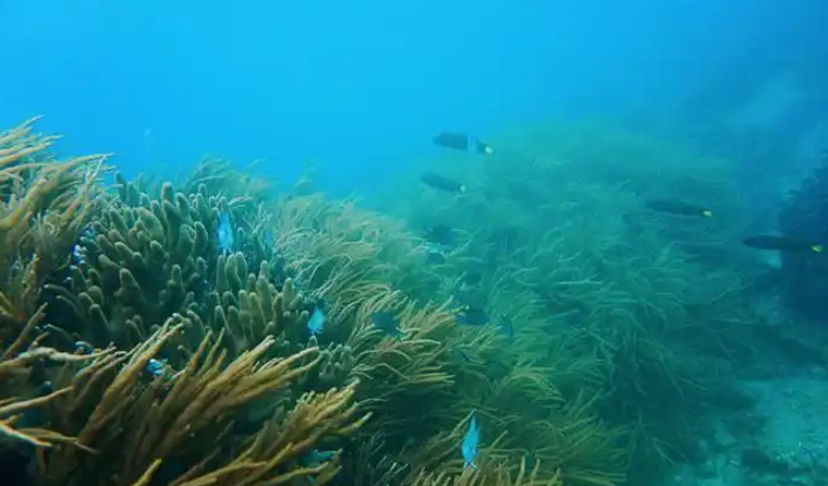
Deep-sea biological resources (such as deep-sea fish, microorganisms, and active substances) have extremely high scientific research and economic value. Deep-sea cameras are core tools for discovering and recording such resources, breaking through the limitations of traditional trawl sampling:
-
Deep-Sea Biodiversity Survey: In the deep-sea area of 200-11,000 meters, cameras can record the types and distribution of organisms in different water layers through a combination of "fixed-point shooting and mobile cruising". For example, in the mesopelagic zone (200-1,000 meters), low-light imaging is used to capture the shape and luminescent characteristics of bioluminescent organisms such as lanternfish and hatchetfish. In the hadal zone (below 6,000 meters), the activity status of high-pressure-tolerant organisms such as snailfish and amphipods is captured, and new species (e.g., the new type of hadal snailfish discovered in the Mariana Trench in 2021) are found. At the same time, the population density of organisms (e.g., the number of organisms appearing in the image per unit time) is counted, and the differences in biological communities in different deep-sea environments (e.g., hydrothermal areas, seamount areas) are analyzed, providing image data for the construction of deep-sea biological resource banks.
-
Assistance in the Exploration of Bioactive Substances: Some deep-sea organisms (such as deep-sea sponges and corals) can produce bioactive substances with medicinal value. Cameras can accurately locate the growth areas of such organisms (e.g., cold seeps, seamount tops), observe their growth morphology (e.g., sponge volume, coral colony size) and attachment environment (e.g., attachment substrate type, water flow speed), and provide accurate locations for subsequent scientific sampling. Compared with traditional trawl sampling, which easily damages the integrity of organisms, fixed-point sampling guided by cameras can maximize the retention of biological activity and improve the efficiency of active substance extraction. At the same time, the symbiotic relationship between organisms and the surrounding environment (e.g., the interaction between deep-sea corals and symbiotic algae) is recorded, providing a research basis for the sustainable utilization of biological resources.
In the field of deep-sea resource exploration, deep-sea cameras solve the pain points of "abstract data and difficult risk judgment" in traditional exploration through "visual presentation". On the one hand, their intuitive image data can improve the accuracy of resource positioning (e.g., reducing the positioning error of mineral-rich areas to within 10 meters) and reduce exploration risks (e.g., avoiding wellhead leakage and geological disasters in advance). On the other hand, the full-process image recording provides traceable evidence for resource assessment and environmental review, promoting the transformation of deep-sea resource exploration from "extensive detection" to "precision, environmental protection, and high efficiency" and providing key technical support for global deep-sea resource development.